Merging GIS with Spreadsheets
FIeldshare unites the flexibility and familiarity of spreadsheets with maps, allowing you to manage your projects in a more streamlined manner.
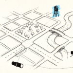
In order to successfully manage projects over one or multiple sites, clear communication and extensive coordination is required. Not only does information need to be accurately relayed to multiple parties, that data needs to be contextualized to specific geographic locations and conditions. These conditions may often change the very next day.
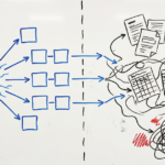
Thankfully, we live in a time where GIS solutions are readily available on the market. Project managers can now make better decisions more quickly. However, two challenges remain. First, coordinating between the geospatial information produced by GIS and the project data held on spreadsheets remains a challenge, even on the same workstation. Second and more fundamentally, geospatial data produced by GIS is difficult to edit and manipulate to the project manager’s needs.
“The way in which we input geospatial data into a GIS has traditionally been a time-consuming process,” Fieldshare founder and CEO Chris Kam shares. “This data usually comes in the form of raster images, which doesn’t allow for project data to be annotated onto it. So companies have had to find solutions to create vector data, which is editable, from those images. In my experience, I’ve seen one company employ a team of CAD technicians just for this purpose – to create vector versions of maps from which managers can then plot the data necessary to track the progress of their projects. But, this is where Fieldshare comes in.”
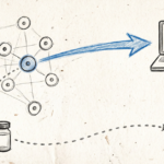
Fieldshare is revolutionary because it seamlessly integrates project data with its own built-in GIS solution. It allows managers to easily annotate that information onto maps, drawings, and other geospatial data. Project information will still remain in tabular format — so you can choose which view works best for you. When you open your project in Fieldshare, a detailed summary combined with the overhead map of the job site allows you to quickly get a handle on what’s going on and what needs to happen next. Using geospatial data has never been easier.